San Joaquin County Evacuation Map
Ripon, California
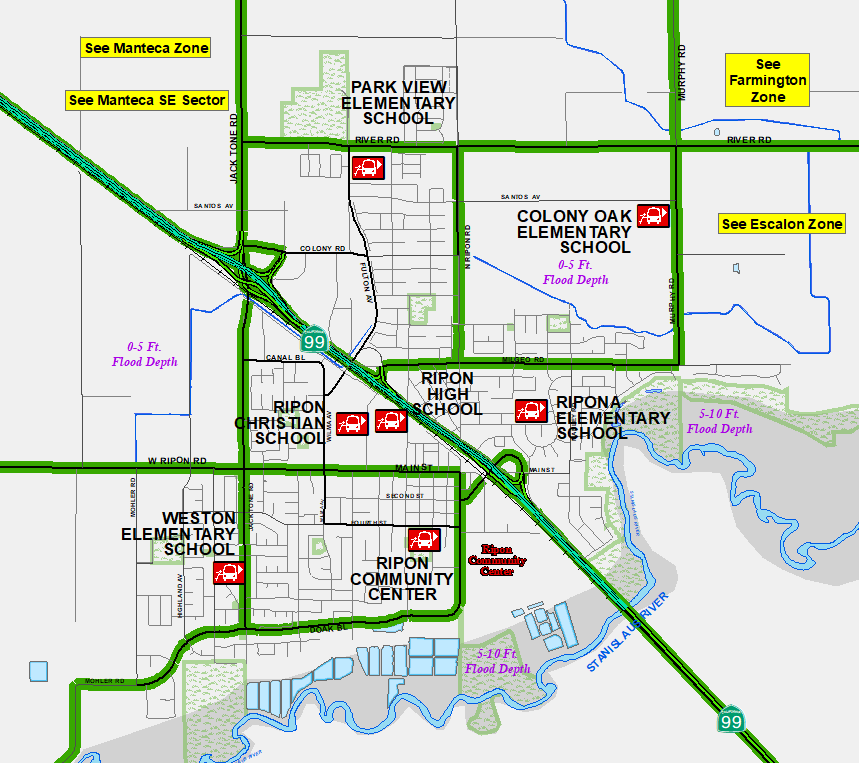
RIPON ZONE RALLY POINTS
Click to read about Rally Points Rally points are places to seek help if you cannot leave the area on your own
Links to Nearby Evacuation Zones:
Escalon
Farmington
Manteca
Manteca SE
San Joaquin County
Click on a rally point to see the aerial view of that area.
Brochures and Map
Ripon Zone
(These are not FEMA Flood Insurance maps)
NEWS:
LEGAL DISCLAIMER: This map and information is for reference purposes only
and is not to be construed or used as a legal document or survey instrument. Any
reliance on the information contained herein is at the user's own risk and
should be verified by independent analysis. This information is broad-based and
for your convenience. This information should not be relied on for decisions
related to purchasing or developing land. The County of San Joaquin gives no
warranty, express or implied, as to the accuracy, reliability, utility or
completeness of this information.