San Joaquin County Evacuation Maps
Lodi, California

(These are not FEMA Flood Insurance maps)

LODI CENTRAL ZONE
RALLY POINTS

Rally points are places to seek help if you cannot leave the area on your own
Green lines on the streets indicate routes to take to leave the area during an evacuation.


Click on a rally point symbol to see the aerial view of that area.
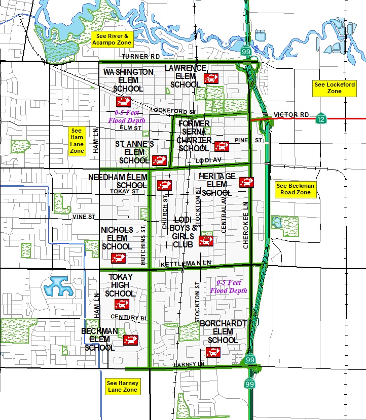
Lodi Central Lawrence Elementary School Washington Elementary School St. Anne's Elementary School Heritage Elementary School Needham Elementary School Nichols Elementary School Tokay High School Borchardt Elementary School Beckman Elementary School Lodi Boys and Girls Club Serna Charter School Harney Lane Lodi Ham Lane Lodi River & Acampo Lodi Beckman Road Lockeford


Links to
Lodi Central
Brochures and Map

   Brochure (English)
   Folleto (Spanish)


PDF map of
Lodi Central Zone

   (English)
   (Spanish)


Links to Nearby
Evacuation Zones

   Beckman Road
   Ham Lane
   Harney Lane
   River/Acampo
   Lockeford

   Countywide View

NEWS:
2010-09-29: Creating the beta version of this webpage.
2010-12-21: Live version of this webpage completed.
2011-04-04: Added links to brochures.
2024-01-10: Updated map links and Rally Point image.

LEGAL DISCLAIMER:
This map and information is for reference purposes only and is not to be construed or used as a legal document or survey instrument. Any reliance on the information contained herein is at the user's own risk and should be verified by independent analysis. This information is broad-based and for your convenience. This information should not be relied on for decisions related to purchasing or developing land. The County of San Joaquin gives no warranty, express or implied, as to the accuracy, reliability, utility or completeness of this information.